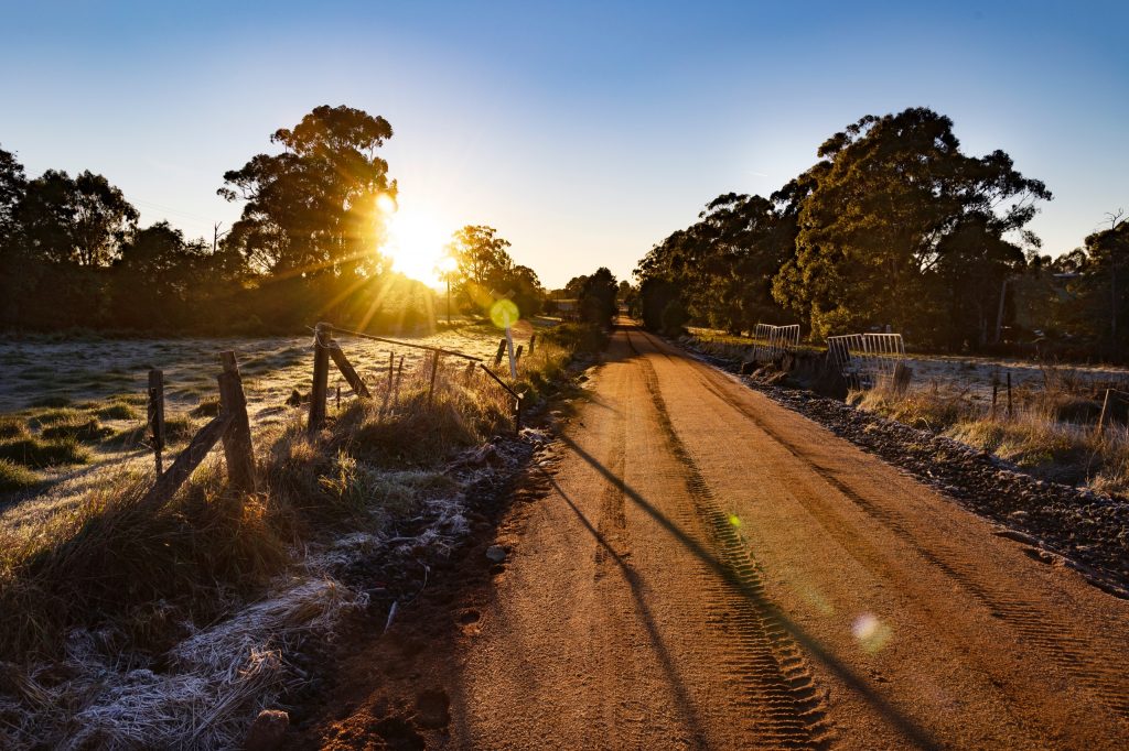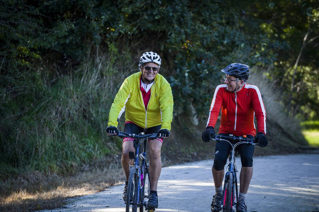
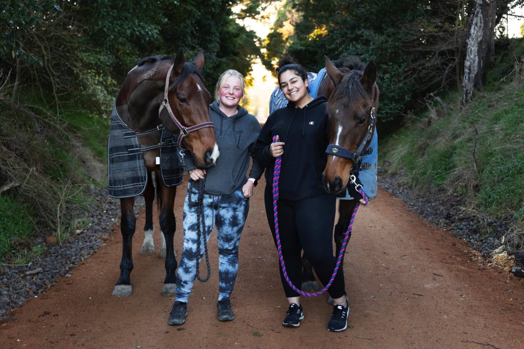
Walk, cycle or ride your horse through South Gippsland on the region's premier rail trail.
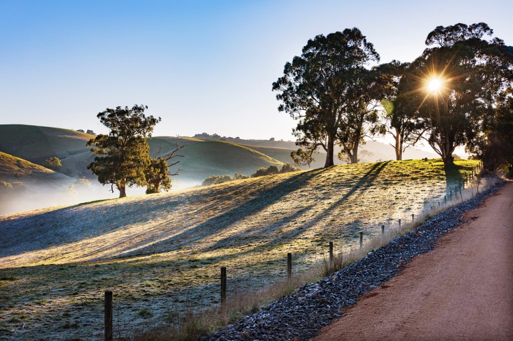
Walk, cycle or ride 130 kilometres on The Great Southern Rail Trail. It is suitable for both the energetic and not so energetic outdoor enthusiast. From Nyora the trail goes through Loch, Korumburra, Leongatha Koonwarra, Meeniyan, Stony Creek, Buffalo, Fish Creek, Foster, Toora, Welshpool, Alberton and Yarram, offering rural and bush views along the way
As you ride the trail, make sure to stop and explore the towns that are linked along it. You will be amazed at the unique stories and experiences they offer… as well as the terrific coffee, shopping and dining opportunities.
Suitable for walking, cycling and horse riding.
130km one-way compact gravel surface
Dogs are allowed on a leash.
The terrain is gentle and accessible for wheelchairs in certain sections.
Distance: (5.5km)
A short downhill section passing pockets of bushland, and ending at a leafy gully, cut by Allsop Creek. It is a short walk or ride across the highway to the town centre. This section includes two bridges over Allsop Creek and Bass River and at Nyora you can enjoy attractions such as the Speedway, Nyora Recreation Reserve and Nyora Railway Station buildings.
Parking
Nyora: Henley Street (in front of the station) & Mitchell Street (Short walk across Nyora Playground Reserve)
Loch: Parking available in town (walk through the railway underpass), Parking available at Loch Memorial Reserve (walk across suspension bridge) & Loch railway siding (grassed area)
Distance: (15.8km)
This section of trail runs passes the Loch railway station and the old Jeetho Station site. It also runs under six road bridges: Bass Valley Road, Main Road, Bena Kongwak Road, South Gippsland Highway and Loch Poowong Road. This section of trail includes Hilda Falls – where a small viewing platform is planned to enable rail trail users to safely view the falls form the trail. There is a connection from the trail to the Loch Recreation Reserve via a suspension bridge and a connection to the Loch township via a tunnel under the South Gippsland Highway. A market is held regularly near the Loch Station during the warmer months.
Parking
Loch: Parking available in town (walk through the railway underpass), Parking available at Loch Memorial Reserve (walk across suspension bridge) & Loch railway siding (grassed area).
Korumburra: Car park behind Kelly’s Bakery and Post Office (Commercial Street)
Distance: (14.8km)
This section of trail runs parallel to the South Gippsland Highway through picturesque countryside. The trail passes the site of the old Ruby and Kardella Station site and across a number of bridges. It is easy to connect to both townships from the trail.
Parking:
Korumburra: Car park behind Kelly’s Bakery and Post Office (Commercial Street)
Ruby: Car park at Ruby Hall (Dykes Road, Ruby)
Leongatha: Car parking available at Leongatha Railway Station (enter from Long Street), Car and long vehicle parking area available in Station Complex (enter from Mccartin Street, behind Sweet Life Cafe).
Distance: (7.8km)
This section of trail begins in Horticultural Park in Young Street, Leongatha. It is a gentle descent to Koonwarra, past farmland, lowland forest and wetlands. Vegetation includes swamp scrub and wetland plants; herons and ducks may be seen. You are welcomed by an avenue of trees as you enter Koonwarra, a picturesque village known for its local produce, sustainable living and monthly farmers market.
Parking
Leongatha: Parking is available in front of Horticultural Park (additional in Young Street).
Koonwarra: Parking is available along Swan Road.
Distance: (8.2km)
This section of the trail winds its way through the Black Spur, named after the creek, that flows beneath. Pass through lush fern gullies before taking in expansive views of the flats surrounding Tarwin River. The trail continues to Meeniyan where it meanders close to the main street. Access this friendly town through Tanderra Park and explore its gallery, shops, cafes and restaurants.
This section of the trail also features the Koonwarra Biodiversity Walk – an interpretive walk spanning 2km.
Parking
Koonwarra: Parking is available along Swan Road.
Meeniyan: Parking is available along Thompkins Road.
Distance: (18.3km)
Here the trail begins the long diversion south that the railway took to avoid the steep Foster Hills. This diverse section of the trail offers views of productive pastures, giant gum trees and flowing creeks. There is a gentle rise in the gradient of the trail as you leave the park at Buffalo and head towards the artistic village of Fish Creek.
Parking
Meeniyan: Parking is available along Thompkins Road.
Fish Creek: Parking is located just off Falls Rd, behind the BP service station car park.
Distance: (12.4km)
From Fish Creek the trail climbs a valley on the west side of the Hoddle Range and crosses the summit at an elevation of 140m just past Lowrys Road. As you travel along this section you will enjoy views of Corner Inlet and the peaks of Wilsons Promontory National Park. There is a lot of dense forest along the side of the trail, with a variety of plants including tree ferns and orchids and a range of birdlife. As you complete this section of trail, you arrive at Foster Station Park. It is just a short 1.5km detour from here into the township of Foster.
Parking
Fish Creek: Parking is located just off Falls Rd, behind the BP service station car park.
Foster: Parking is at Foster Station Park, located off Station Rd, Foster.
Distance: (10.2km)
This section is a leisurely journey with an ever-changing view. From dairy farms and gum tree glades, to rivers, rolling hills and wind turbines. This gentle section of the trail is ideal for young families to explore.
Parking
Foster: Parking is at Foster Station Park, located off Station Rd, Foster.
Toora: The car park can be accessed from Toora Jetty Road.
Distance: (10.2km)
The best of both worlds, you will travel through bushland and past extensive dairy farms, with views to Corner Inlet. This section is flat, making it suitable for all fitness levels and perfect for families.
Parking
Toora: The car park can be accessed from Toora Jetty Road.
Welshpool: Parking is located off South Gippsland Hwy at Memorial Hall Reserve.
Distance: (20.5km)
Travel through paddocks on this flat, straight section until you reach a highway crossing at Hedley. As the trail becomes separated from the highway, enter a peaceful part of the trail, filled with butterfly swarms and the occasional eagle.
Ride under pine trees, leaving a dusting of needles over the gravel trail, as the flora changes to tea tree scrub then to gums, past a series of small creek crossings.
Cross over the Albert River and glide into Alberton, arriving in town at the Victoria Hotel.
Parking
Welshpool: Parking is located off South Gippsland Highway at Memorial Hall Reserve
Distance: (5.8km)
This is a short and very flat section. From the northern edge of town, cross the highway and head east onto the gravel path. The trail is bound by a thin stretch of bushland, affording glimpses of paddocks through young gums.
A second highway crossing keeps you on your journey north. The wide gravel path cuts through a patchwork of fields, where the landscape opens up to reveal wide horizons and big skies, thanks to the very flat terrain.
The wide, well-formed gravel path makes an easy ride. As you reach Yarram, you’ll pass tranquil wetlands, a pump track and the scenic landscaped gardens of Tarra Trail Reserve. This is the end of the trail, a couple of blocks west of the town centre.
Parking
Yarram: Tarra Trail Reserve, Lawler Street
Distance: (5km)
The trail winds its way through the streets of Welshpool before continuing along to the coast. This is a short 5km flat section as you approach the end of the Great Southern Rail Trail and the fishing town of Port Welshpool. Enjoy views of Corner Inlet, Snake Island and the northern section of Wilsons Promontory National Park.
Parking
Welshpool: Parking is located off South Gippsland Hwy at Memorial Hall Reserve.
Port Welshpool: Parking is located off Lewis St, at the ferry terminal car park.
This short and flat section along a wide gravel path makes for very easy riding. A shared concrete pathway passes through Alberton’s town centre, with a highway crossing at the southern end of town.
A thin wedge of shrubbery on the right separates you from the highway, while you pass fields of curious cows on your left, giving way to peaceful bushland on Port Albert’s outskirts.
There’s a small creek crossing followed by a series of sharp turns, twisting around paddock boundary lines. A couple of kilometres south of Alberton you’ll see a turn off to the historical Alberton Cemetery. As you arrive into Port Albert, a shared concrete footpath takes you to the town centre and waterfront.
Parking:
Port Albert: Rutter Park, Bay Street.
The Great Southern Rail Trail is far from the only walking track in South Gippsland. There are many more walking tracks available both in and out of Wilsons Promontory National Park.